2. Relief
43
2
34.
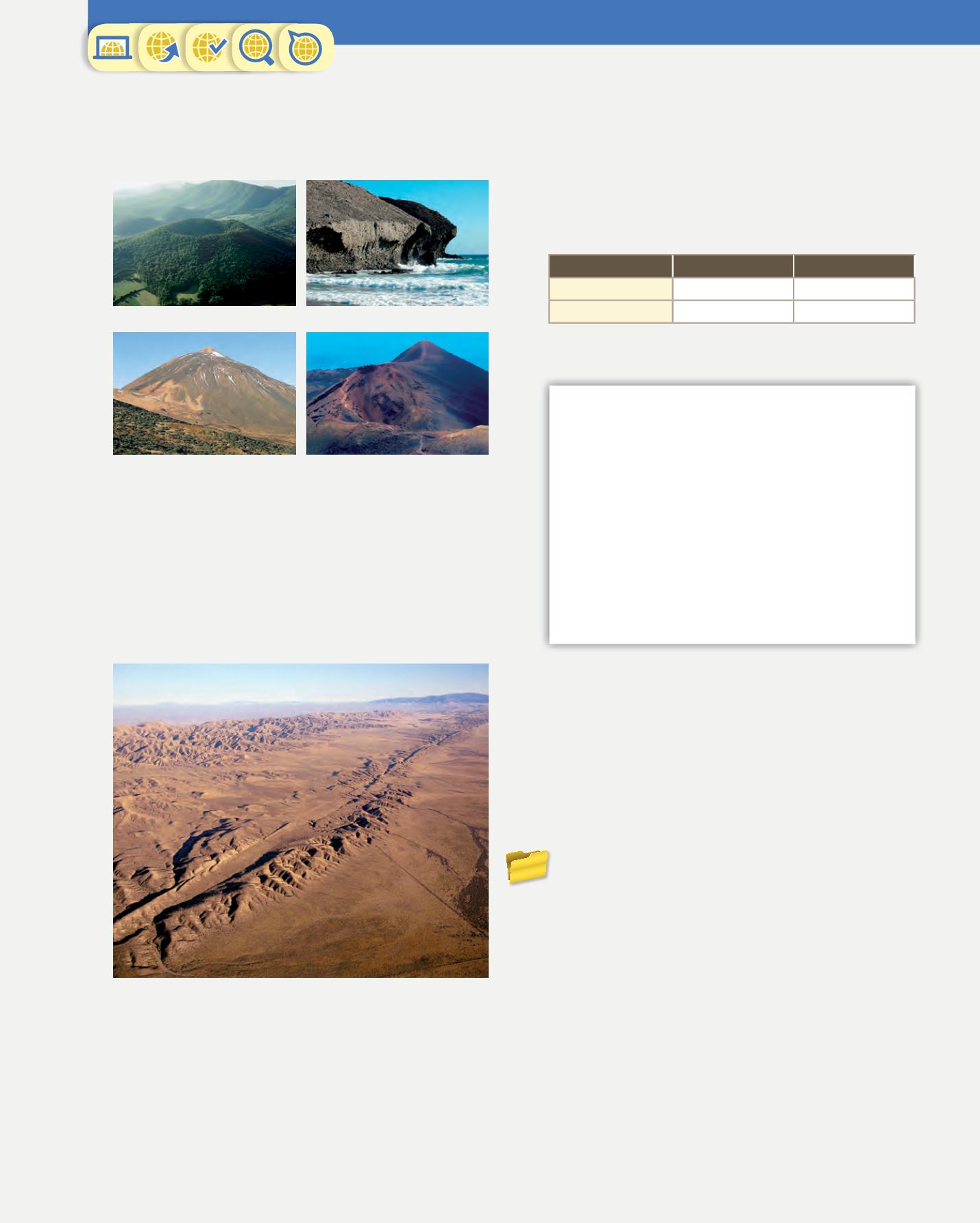
Find out about the location of these volcanic
landforms. Indicate the province, the autonomous
communityofeachoneandtheirmaincharacteristics.
35.
Look at the aerial view of the San Andreas fault.
a) Find out where it’s located.
b) Explain how it was formed.
c) List its main characteristics.
d) Name some geological hazards that it could cause
and explain their characteristics.
36.
Answer these questions about the ocean floor.
a) What is an ocean ridge and an ocean trench?
b) What phenomenon can occur under sea in the areas
of contact between tectonic plates?
c) What geological hazards originate on the ocean
floor?
Two big earthquakes hit Lorca
The southern Spanish town of Lorca, Murcia, was hit
by a major earthquake, killing at least 10 people and
injuring 167. Some 20 000 residents have spent the night
outside, afraid of another earthquake and collapsing
buildings. The earthquake registered 5.2 on the Richter
scale. Several buildings fell, crushing cars and a hospital
was evacuated as a precaution. Spain has hundreds of
earthquakes every year, but most of them are too small
to be noticed. Murcia is close to a large fault line beneath
the Mediterranean Sea where the European and African
continents meet.
BBC News,
12 May, 2011
(Adapted)
Sant Margarita volcano, Olot
Volcanic rock, cabo de Gata
Mount Teide volcano, Tenerife Teneguía volcano, La Palma island
37.
An example of the action of rivers is the formation
of canyons and gorges. Look for information on
the Internet about major canyons and gorges in
Spain. Explain where they are and which river
formed them.
38.
Copy and complete the table in your notebook.
Similarities
Differences
Fold
Fault
39.
Read the text and answer the questions.
a) Which autonomous community does Lorca belong
to?
b) Why did the residents of Lorca spend the night
outside?
c) Why is the risk of an earthquake occurring greater in
Murcia?
d) What are the effects of an earthquake on a town
and its residents?
40.
You are going on a hiking trip and you have a map
with your route marked. You need to be clear about
the landforms on your route. Make an fact file for
each pair of landforms below. Draw and label the
landforms, and indicate the differences between
them.
a) Hill and mountain
b) Gulf and cape
c) Island and peninsula
d) Lagoon and marsh
e) Marsh and estuary


