OUP00_CABECERO_BLANCO
OUP00_CABECERO_BLANCO
1
32
Geography
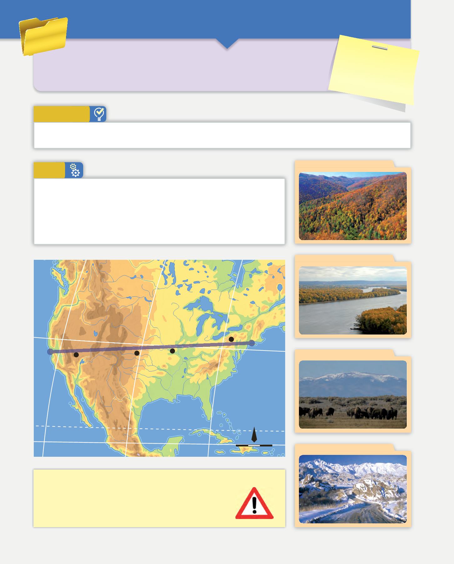
Once you have the map, draw different routes on it.
Here is as an example of a possible route for an expedition across North America,
with the geographic units along a line from New York, on the Atlantic coast and
San Francisco, on the Pacific coast.
The numbers that appear on the map refer to the natural units. As you can see,
each one corresponds to a characteristic image.
Tasks
Let’s see the world!
1
How well do you know the world? Do you like adventure? For this task, you will set a
route and gather information that you find on the way to show to others later. Take
your travel companions and become an expert geographer, discovering the continents
through their main natural geographic units.
Get into groups. Each group chooses a different continent, so that all the continents are represented. Print out or draw a map
of the continent you have chosen.
Preparation
MATERIALS
❚
Notebook
❚
Maps of the continents
❚
Computer with Internet
access
Besides the information you collect in your portfolio, you can use the following
websites:
/
1 000 km
0
1:53 191 000
N
Appalachian Mountains
ROCKY MOUNTAINS
G
r
e
a
t
P
l
a
i
n
s
AT L A N T I C
O C E A N
P A C I F I C
O C E A N
R
i
o
G
r
a
n
d
e
C
o
l
o
r
a
d
o
M
i
s
s
i
s
s
i
p
p
i
S
a
i
n
t
L
a
w
r
e
n
c
e
Lake
Superior
Lake
Huron
Lake Erie
Lake Ontario
Sierra Nevada
Lake
Michigan
NEW YORK
SAN
FRANCISCO
40º N
120º W
100º W
80º W
20º N
Tropic of Cancer
2
3
1
4
1. Appalachians Mountains
2. Mississippi
3. Great Plains
4. Sierra Nevada (California)


