1
1. The world’s natural environment
15
THE STUDY OF THE NATURAL ENVIRONMENT THROUGH IMAGES
Photography
Photography shows landscapes where different landforms can be distinguished
(mountains, valleys) and diverse elements (glaciers, forests, prairies, crops). It is
an important tool because it establishes the relation between these elements and
allows us to understand the landscape. The photo on the right shows a panoramic
view of the Valley of Flowers national park (in the Himalayas, India). There is a rich
flora with many endemic species. The fauna includes the snow leopard and Tibetan
bear.
Aerial photography
Photographs taken from
airplanes or satellites show
large areas, such as New
York, situated where the
Hudson River flows into the
Atlantic
Ocean.
Aerial
photography provides a
wide range of views of
specific places, the uses of
soil, and many other aspects.
Thematic maps
These are an important tool for geographers. They provide
important information about many different facts or
geographical phenomena (population, economy, crops,
climate, vegetation, or transport). The map on the left shows
the population density in different regions of China.
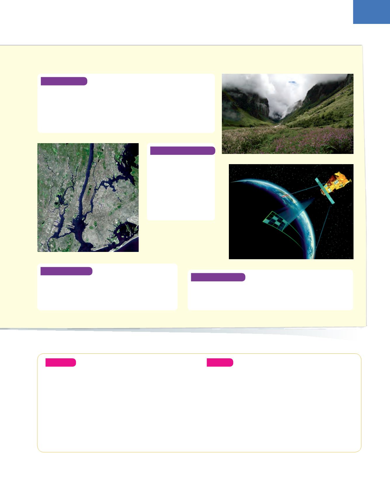
Remote sensing
This is based on images taken from satellites. It shows different images in real
time, from meteorological phenomena that help us to predict the weather,
to others that provide information about towns, fires, plagues, movements
of troops, buried archaeological remains and so on.
Analyse
6.
Look at the glacial valley on page 14. What kind of
landforms are created by glaciers? What is the climate
in glacial areas? What is the vegetation like: abundant
or scarce?
7.
Imagine a savannah with gazelles on it. What is the
relief like? What is the predominant vegetation? What
do the gazelles eat? What other animals are found in
this environment?
8.
Study themapof Chinaonpage14.What is thepopulation
density in the west? How is it represented on the map?
Create
9.
Find out how remote sensing is used to predict the
weather or forest fires.
❚
What advantages does it have over terrestrial
observation? Is it a static or dynamic observation?
❚
What information does it provide about a fire that
cannot be appreciated from terrestrial observation?
Can it help to control or extinguish the fire? Write a
short essay about your findings.


