TYPES OF MAP PROJECTION
1
16
Did you know?
In the 16th century, the
cartographer Gerardus Mercator
put an image of the
mythological Titan Atlas on the
cover of his books of maps.
Atlas was condemned to hold
the heavens on his shoulders.
This is where the name of this
type of book comes from.
4. THE REPRESENTATION OF THE EARTH
The most difficult thing about making maps is how to represent the Earth’s sphere on
a flat surface.
Map projections
make this possible.
4.1. Map projections
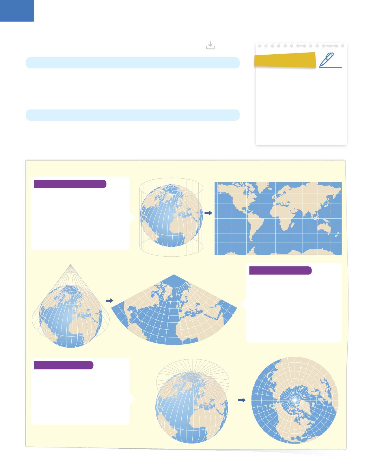
There are many types of map projections, but the main three are:
cylindrical
,
conical
and
planar
.
Cartography
is the
science
of studying and
making maps
.
A
projection
is the result of projecting a 3D image onto a flat surface.
Conical projection
In a conical projection, the globe is
projected onto a cone. When opened up
it is shaped like a fan.
The globe touches the cone at the tropics
lines, so it is the best type of projection
for
medium latitudes
.
On the flat surface, the meridians are
converted into straight lines, starting at
the pole and the parallels take the shape
of arcs of concentric
7
circles.
Planar projection
In a planar (or azimuth) projection, the
globe is projected onto a flat surface. The
result is a circular projection. The globe
only touches the flat surface at the pole
which is being mapped
8
.
This is the best type of projection for
the polar regions. It also shows a whole
hemisphere.
Cylindrical projection
A cylindrical projection is made by
wrapping a cylinder around a globe and
projecting the details of the globe onto the
surface to make a
world map
.
The globe touches the cylinder at the
Equator and so there is more distortion
in the areas further from it. This type of
projection is used to represent the
entire
world
.


