The Earth’s movements
❚❚
Rotation
is the movement the Earth makes as it turns on its own axis.
One rotation takes
24 hours
and causes
day
and
night
.
❚❚
Revolution
is the movement of the Earth around the Sun. It takes
365 days and 6 hours and causes the seasons.
Geographic coordinates
❚❚
Meridians
and
parallels
form an imaginary
geographic network
on the Earth’s surface which lets us locate the position, or geographic
coordinates of any place in the world by combining
latitude
and
longitude
.
❚❚
Parallels
are imaginary circles parallel to the Equator.
Meridians
are
imaginary semi-circles going from pole to pole.
❚❚
Latitude
is the angular distance between any point on Earth and
the
Equator
(0° latitude). Latitude can be north or south and range
from 0° (the Equator) to 90° (at the poles).
❚❚
Longitude
is the angular distance between any point on Earth and
the
prime
or
Greenwich meridian
. It can be east or west and range
from 0° (Greenwich) to 180° (the
International Date Line
in the
Pacific Ocean).
The representation of the Earth
❚❚
Maps
are true and proportionate representations of the Earth, or a
part of the Earth, on a flat surface. The science of making maps is
called
cartography
.
❚❚
Map projections
are used to show the Earth’s sphere on a flat surface.
The most common are
cylindrical
,
conical
and
planar
projections.
❚❚
Maps can be
topographical
if they show relief or man-made features;
or
thematic
, if they show specific features (physical, political, climate,
etc.).
❚❚
Street maps
show smaller areas, usually cities, towns, urban
infrastructure or buildings.
Plans
show the interior organisation of
buildings.
❚❚
The
scale
is the ratio between the size of the area represented on the
map and its true size in reality. The scale can be
large
,
medium
or
small
, depending on the proportion (or ratio) we use.
Time zones
❚❚
Time zones
are
imaginary
vertical strips on the Earth’s sphere of
15° longitude
each. There are 24 time zones and each strip is equal
to one hour.
❚❚
Time zones allow us to estimate the difference between different
areas and countries.
1. Planet Earth and its representation
21
hot climate
temperate climate
cold climate
desert climate
3 000 km
0
1:198 723 000
N
❚
❚
Based on its
proximity to the Sun
, the Earth
is the third planet in the
Solar System
. It is
sphere-shaped, slightly flattened at its poles.
❚
❚
The Solar System is located in a spiral galaxy
called the
Milky Way
.
❚
❚
The distance from the Sun, the abundance of
water and the existence of an atmosphere
make life on our planet possible.
Planet Earth
KEY CONCEPTS
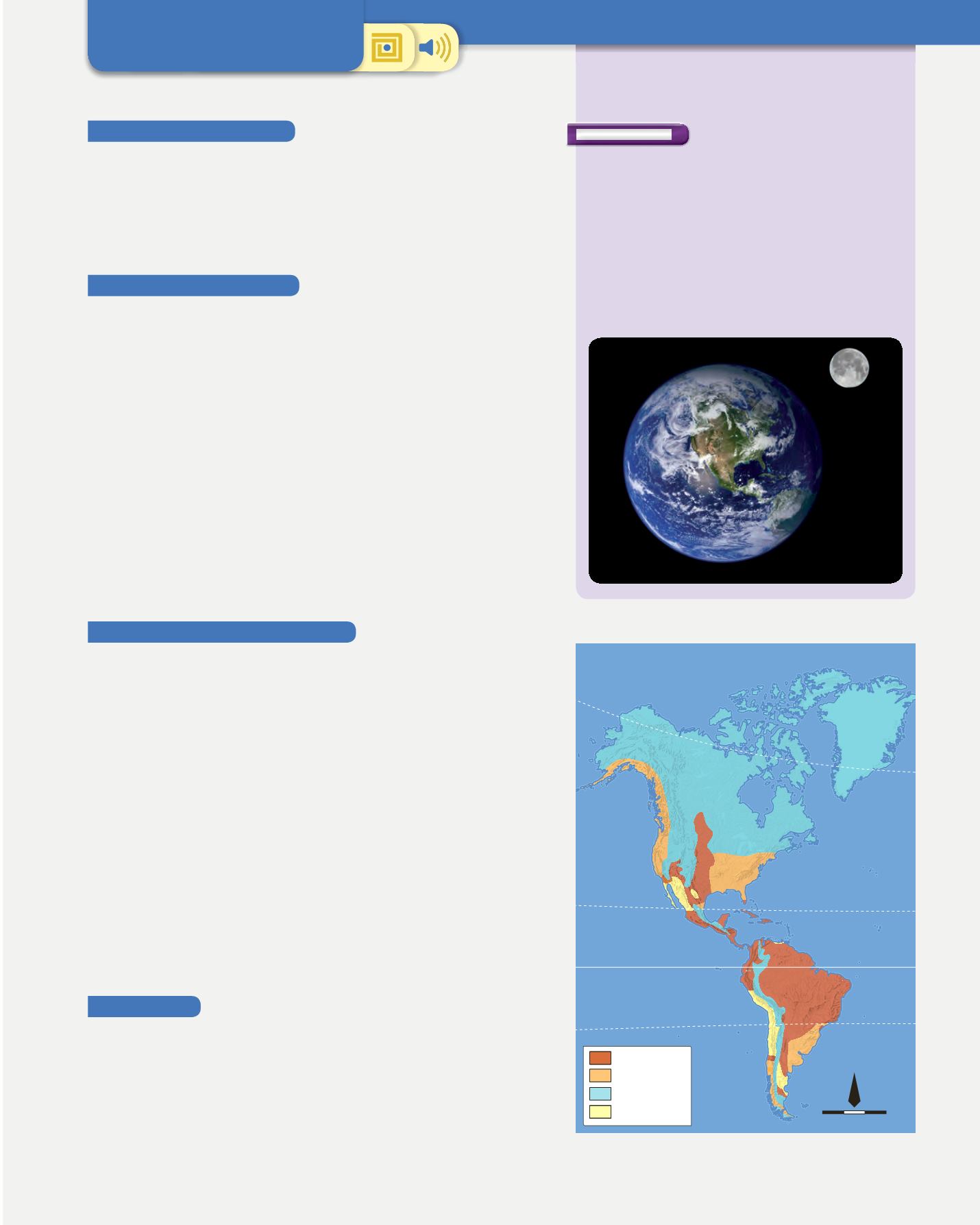
1
Thematic map: climates of America


