Each group presents their experience to the rest of the
class (the route chosen, methods of orientation used and
difficulties). You can present your planned itinerary, images
of the route you took, the methods of orientation you used
and what you did so you did not get lost.
Even if you didn’t actually go out on the route, show your
itinerary and explain the methods of orientation you would
have used.
Communication and publication
ORIENTATION WITH INSTRUMENTS
Nowadays there are many ways to find your way with different instruments. Some
of these have been invented very recently:
❚❚
A
compass
, placed on a flat surface will indicate north.
❚❚
A
map
is used to work out a route. Choose specific places to help you follow
your itinerary and mark which direction you need to go in to get to them (for
example, to get to the forest ranger’s hut, go west). This will help you find the
right path and correct your route if necessary.
❚❚
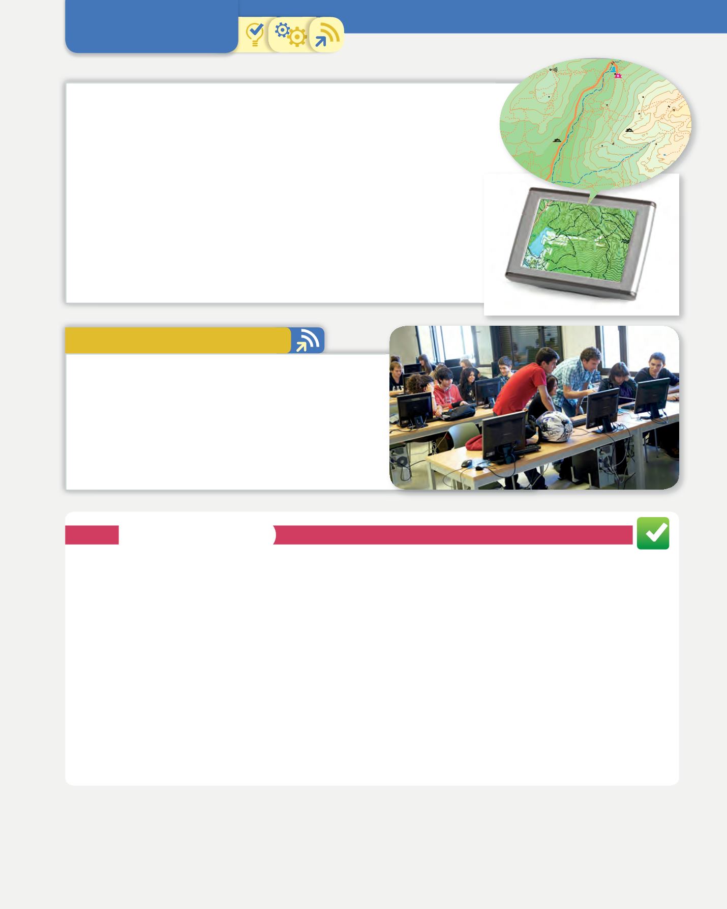
On a
GPS
, the coordinates of a place can be introduced and the directions
followed. It is easy to use, but ask an adult to show you how.
❚❚
Many
mobile phones
now have location tracking services. These show you a
map of the area, your location and what is close by.
Final task
1. Planet Earth and its representation
25
1300
1500
1400
1300
1200
1100
de
la
Majadilla
Arroyo
de
los
Huertos
Charca
Kindelán
Arroyo
Fuente
PedroAcuña
Fuentede
Prado Pino
La Lagunilla
delYelmo
PEÑA SIRIO
(CANCHO DEL
POSTIGO)
Pasarela
Puente
Hueco de las Hoces
Canto
Cochino
Praderade
Los Lobos
B
a
r
r
a
n
c
o
d
e
l
o
s
H
u
e
r
t
o
s
A
u
t
o
p
i
s
t
a
d
e
L
a
P
e
d
r
i
z
a
Refugio Giner
de los Ríos
Chozo
Kindelán
La Cueva
de la Mora
CANCHO DE
LOS MUERTOS
El
Rocódromo
El Madero
El Camello
El Dinosaurio
El Castillo
1382
1453
1362
Pradera
delPradillo
Collado de
la Encina
1453
1453
1303
1378
S
N
O
E
1.
What instruments would you put in your rucksack for an excursion? Explain what you would use each
instrument for.
2.
Which methods of orientation would you recommend to someone who wants to go on an excursion to the
country? Explain why.
3.
If you went somewhere you had never been before, what methods would be the best to avoid getting lost.
4.
What information have you got from maps to do this task?
5.
Which aspect of orientation did you find the most difficult?
6.
Evaluate your participation in group work. Did you participate? What difficulties did you have?
7.
Which of the other groups’ routes would you like to do? Why?
8.
What have you learnt from doing this task?
SELF-ASSESSMENT


