25
20
15
10
300 m
5
0
SCALE 1:5 000
16 km
8
10
12
14
6
4
2
0
SCALE 1: 200 000
2 000
1 600
2 400
2 800
3 600
3 200
4 000 km
1 200
800
400
0
SCALE 1: 40 000 000
1
18
Depending on the ratio
between the size on the map and the real size of the area,
we use three kinds of scale:
small
,
medium
and
large
.
❚❚
Large scale maps
show a lot of detail because they represent small areas and their
denominator is also small. They have a scale of up to 1:50000 and are used to
represent towns, cities, provinces or sections of rivers.
❚❚
Small scale maps
show few details because they represent large areas and their
denominator is very large. They are used to represent the world, continents, large
regions of the Earth or medium to large countries.
SCALE
RATIO
PLACES REPRESENTED
Large
from 1:10000 to 1:100000
cities, towns, provinces
Medium
from 1:100000 to 1:500000
not very large regions and countries
Small
from 1:500000 to 1:50000000 large countries, continents, world maps
Scale
is the
ratio
9
between the size of the area represented on the map and the
real size of the area. It can be expressed
numerically
and
graphically
.
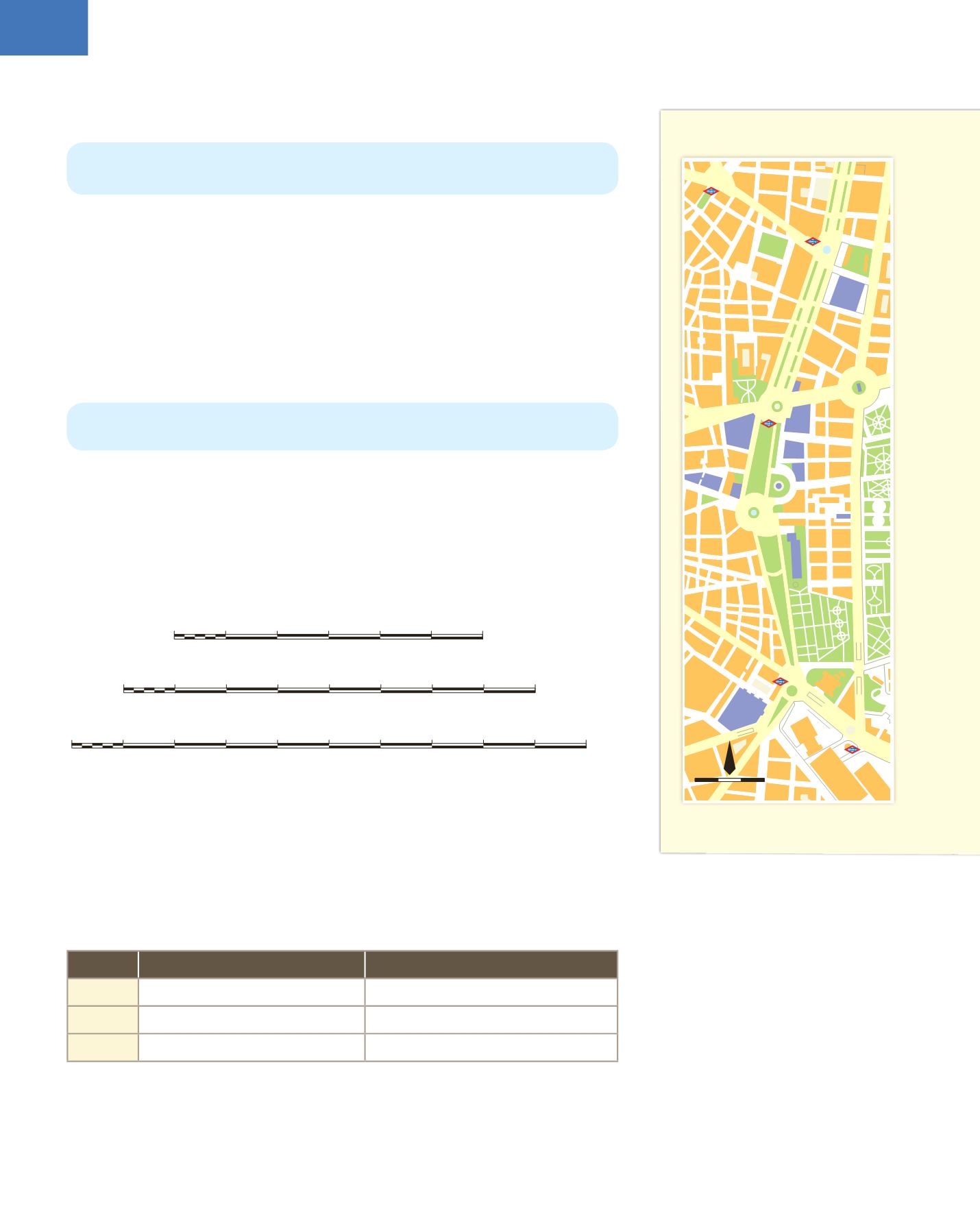
4.3. Street maps and plans
Street maps
represent smaller areas than other maps, such as cities or towns.
Plans
show us how the inside of buildings are organised.
Street maps
are used to show the location of monuments, museums, public buildings
and bus or metro lines.
Plans
show us the interior organisation of buildings or facilities such as hospitals,
museums and schools.
4.4. The scale of maps and plans
Maps and plans represent large areas on small surfaces, so we need to know the
relation between real size and the size shown on the map.
❚❚
Numeric scale
is expressed using a fraction in which the numerator is the unit of
size on the map and the denominator shows the number of equivalent units in real
size. A scale of 1:25 000, means that one unit, for example 1 cm, represents 25 000
centimetres in real size.
❚❚
Graphic scale
indicates the distances on a map using a straight line divided into
equal parts, like a ruler.
Section of a street map of Madrid
Puerta
de Alcalá
Bolsa
Casón del
Buen Retiro
Banco
de España
Estación
de Atocha
Congreso
Ayuntamiento
de Madrid
Museo
Thyssen-
Bornemisza
Museo
del Prado
Museo
Reina Sofía
Biblioteca
Nacional
Museo
Arqueológico
PARQUE
DEL
RETIRO
JARDÍN
BOTÁNICO
Museo Naval
Alonso
Martínez
Colón
Banco
de España
Atocha
Atocha-
Renfe
Plaza del
Emperador
CarlosV
Plaza Cánovas
del Castillo
Plaza de
Cibeles
Plaza de
las Salesas
Plaza de la
Villa de París
Plaza de
Santa Bárbara
Plaza de
Alonso Martínez
Plaza de
Colón
Claudio Moyano
PASEO DEL PRADO
Calle
de
Santa Isabel
CALLE
ATOCHA
Calle de las Huertas
Calle Felipe IV
Calle Montalbán
Antonio Maura
CALLE
DE
ALFONSO XII
CALLE
DE
ALCALÁ
DE
SERRANO
CALLE
Goya
PASEO DE RECOLETOS
Calle
del
Barquillo
Calle
Almirante
CALLE
GÉNOVA
300 m
0
1:17 800
N
9
ratio
:
relation between the size,
number or amount of two things, often
represented by two numbers


