1
1. Planet Earth and its representation
17
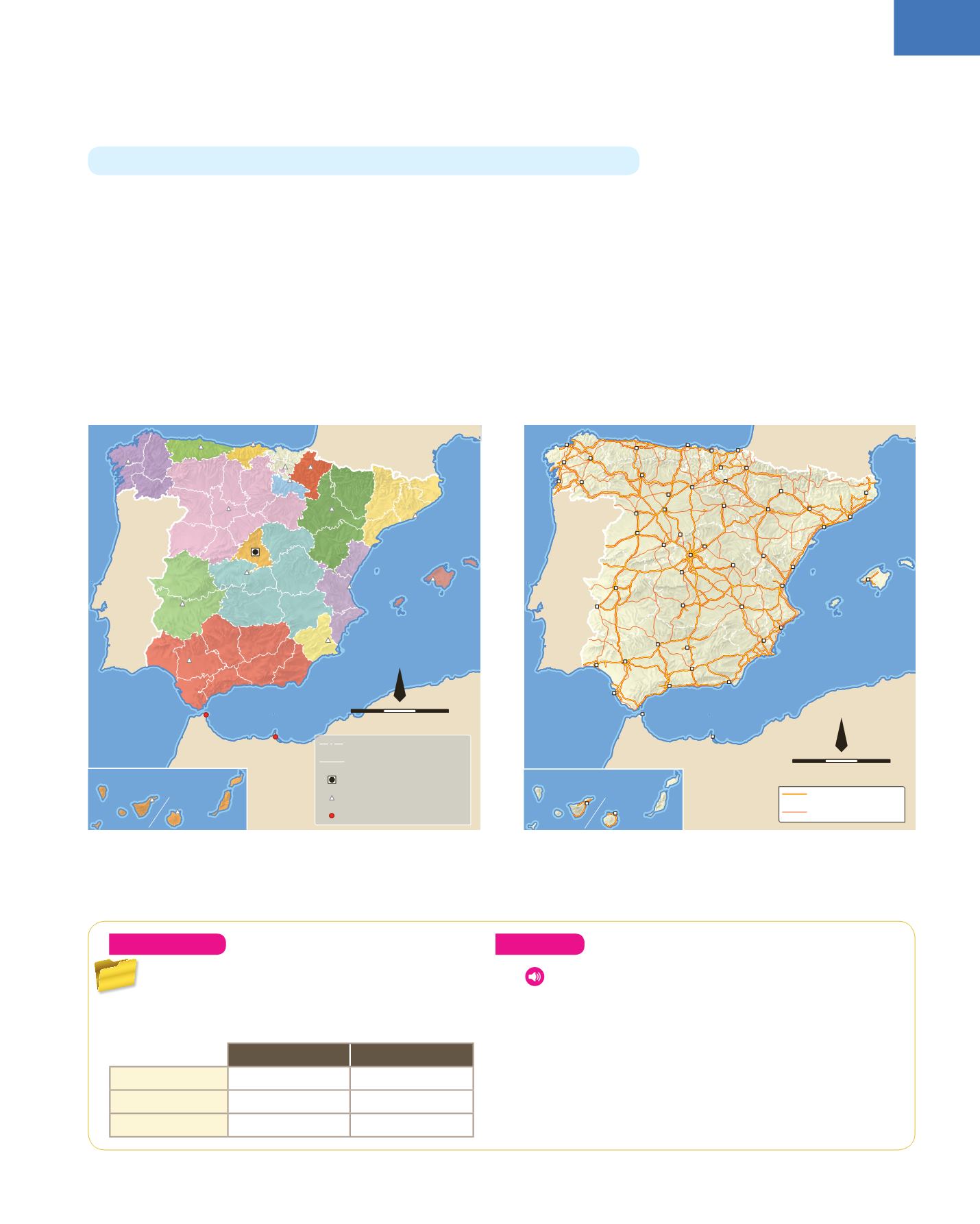
4.2. Maps
Since the ancient past, people have used maps to represent the world. Often, these
primitive maps represented what people knew about the world at the time, more
than the geographic reality. Until Columbus discovered America in 1492, maps only
represented the continents of the Old World: Europe, Africa and Asia.
Nowadays there are many types of maps.
❚❚
Topographic maps
represent in detail the relief, cities, towns or villages, roads
and railways and other features of an area.
❚❚
Thematic maps
show specific aspects of an area. For example, they can be political
(with borders or administrative divisions), show infrastructures (with motorways or
railway lines), show relief, climate or population.
A
map
is the true
representation
of the whole or part of an area on a
flat surface
.
Political map of Spain
Road map of Spain
ANDORRA
PORTUGAL
FRANCE
COMUNIDAD
DE MADRID
CEUTA
MELILLA
CANARIAS
CANTABRIA
CASTILLA-LA MANCHA
ANDALUCÍA
GALICIA
CASTILLA Y LEÓN
PAÍS
VASCO
COM. FORAL
DE NAVARRA
CATALUÑA
ILLES BALEARS
COMUNITAT
VALENCIANA
REGIÓN
DE MURCIA
LA RIOJA
PRINCIPADO
DE ASTURIAS
EXTREMADURA
ARAGÓN
Santiago
de Compostela
Mérida
Zaragoza
Las Palmas
de Gran Canaria
Vitoria-Gasteiz
Logroño
Pamplona/Iruña
Barcelona
Palma
de Mallorca
Valencia
Murcia
Toledo
Madrid
Valladolid
Oviedo Santander
Sevilla
Sta. Cruz
de Tenerife
regional borders
provincial boarders
national capital
regional capitals
autonomous communities
300 km
0
1:13 033 000
N
ANDORRA
PORTUGAL
FRANCE
Zaragoza
Las Palmas
de Gran Canaria
Vitoria-Gasteiz
Logroño
Pamplona/Iruña
Barcelona
Palma
de Mallorca
Valencia
Murcia
Toledo
Madrid
Valladolid
Oviedo
Santander
Sevilla
Sta. Cruz
de Tenerife
A Coruña
Lugo
Ourense
Pontevedra
León
Bilbao
Huesca
Lleida
Girona
Tarragona
Teruel
Soria
Palencia
Burgos
Zamora
Salamanca
Ávila
Segovia
Guadalajara
Cáceres
Badajoz
Cuenca
Ciudad Real
Córdoba Jaén
Granada
Almería
Málaga
Huelva
Cádiz
Alicante
Castellón de
la Plana
Donostia/
San Sebastián
Ceuta
Melilla
motorway
main roads
300 km
0
1:13 033 000
N
7
concentric
:
two or more objects that
share the same centre
8
map (
v
)
:
to find and record the position
of something
Understand
18.
Copy and complete the table in your notebook.
Describe the meridians and parallels for each
type of projection map.
Meridians
Parallels
Cylindrical
Conical
Planar
Analyse
19.
Listen to the questions about map projections and
choose the correct answer.
20.
Read
Did you know?
Explain what a cartographer
does.
21.
Compare a
physical map
and a
political map of Spain
.
Make a table with the features these maps show.


